IDP Camp Suitability Toolbox
This toolbox provides a quick assessment of flood risks and water security
in existing IDP camps, while also evaluating the biophysical conditions of
potential new sites. It aims to support data-driven decision-making for selecting
suitable locations and prioritizing interventions in both current and new IDP camps.
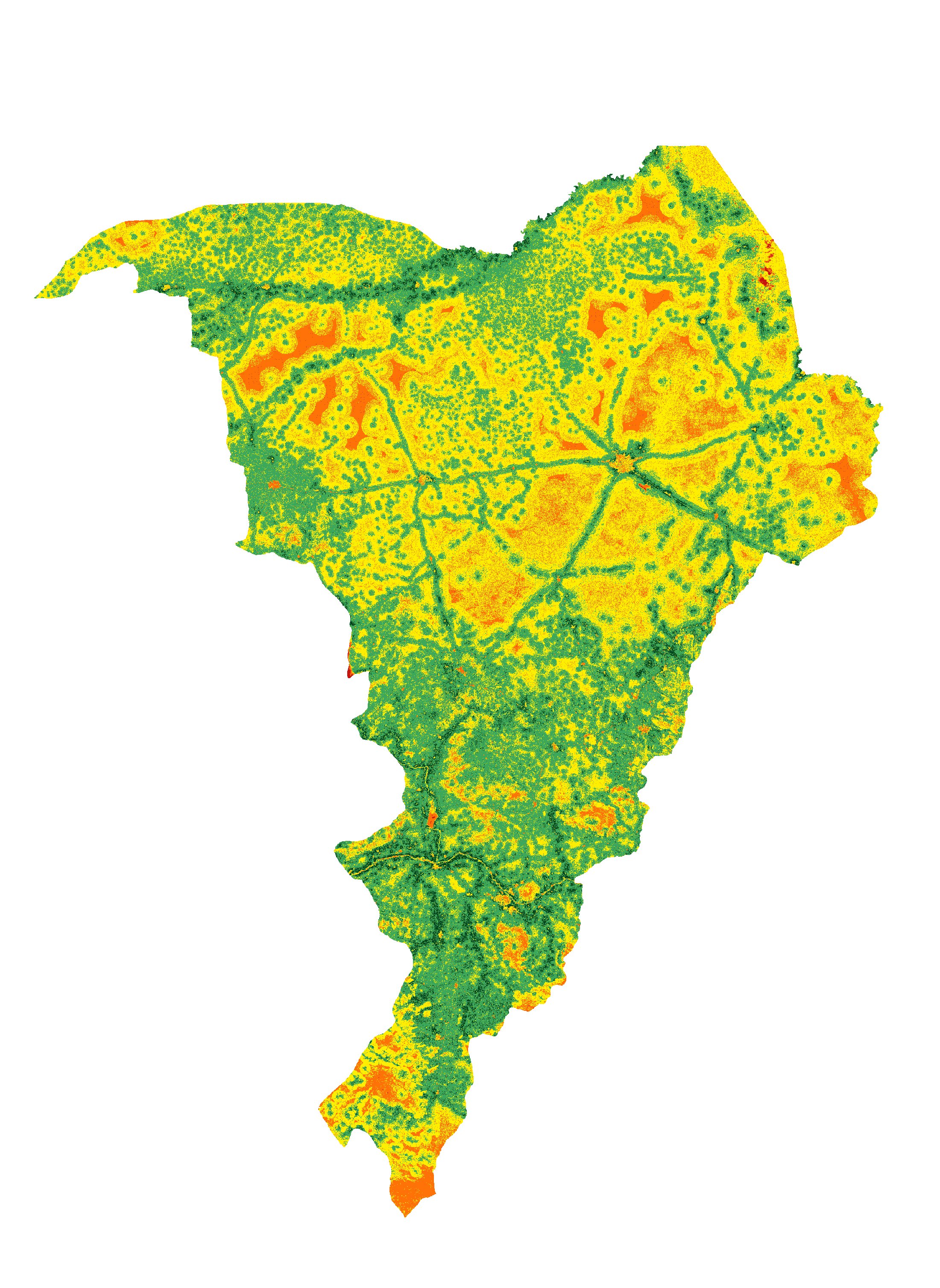
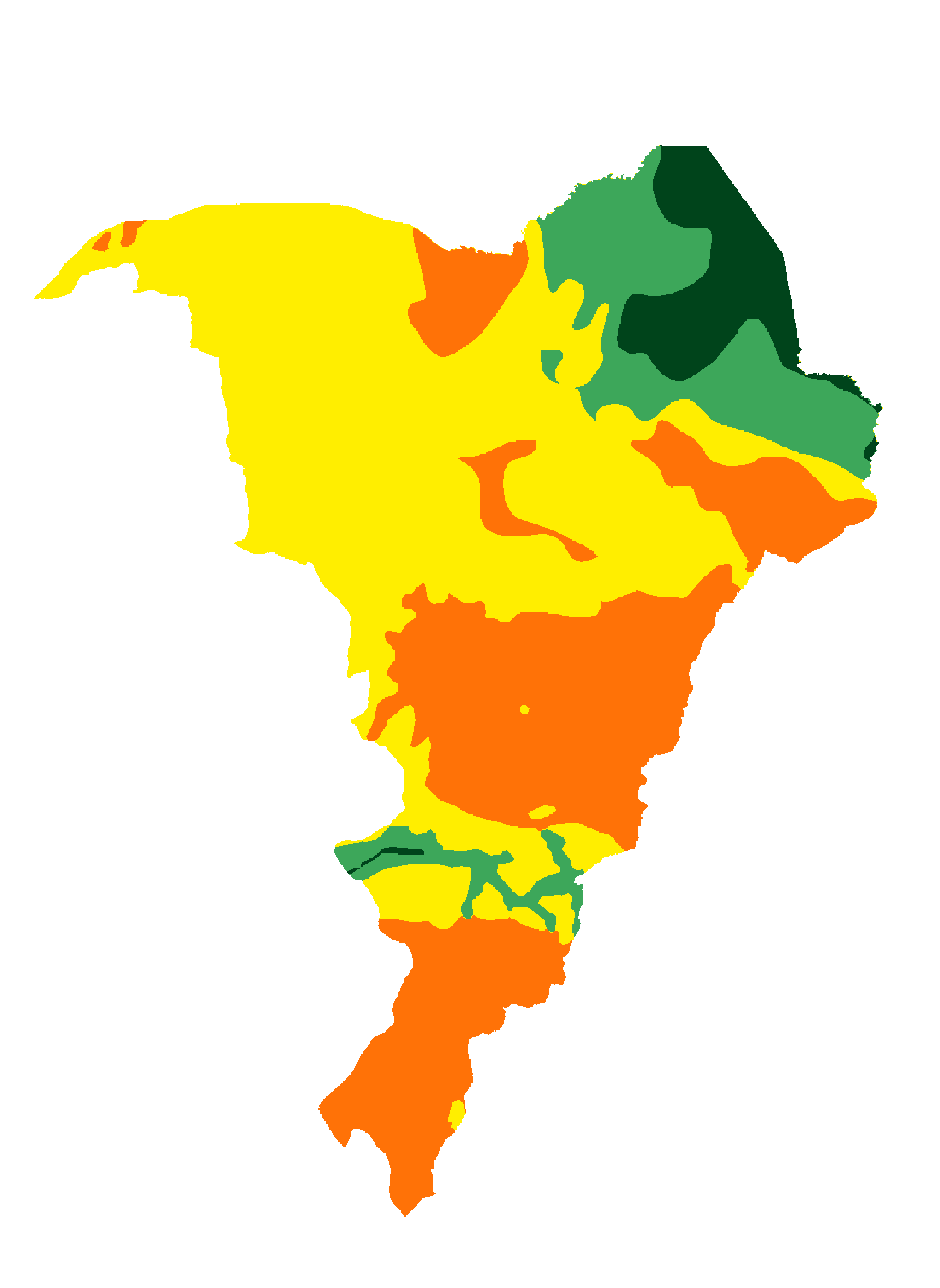
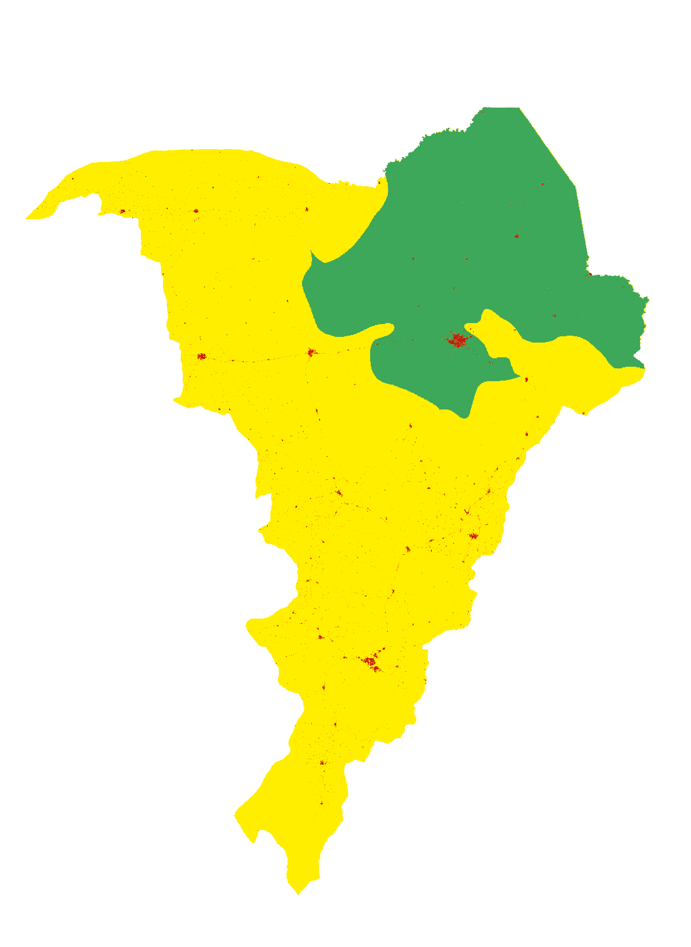
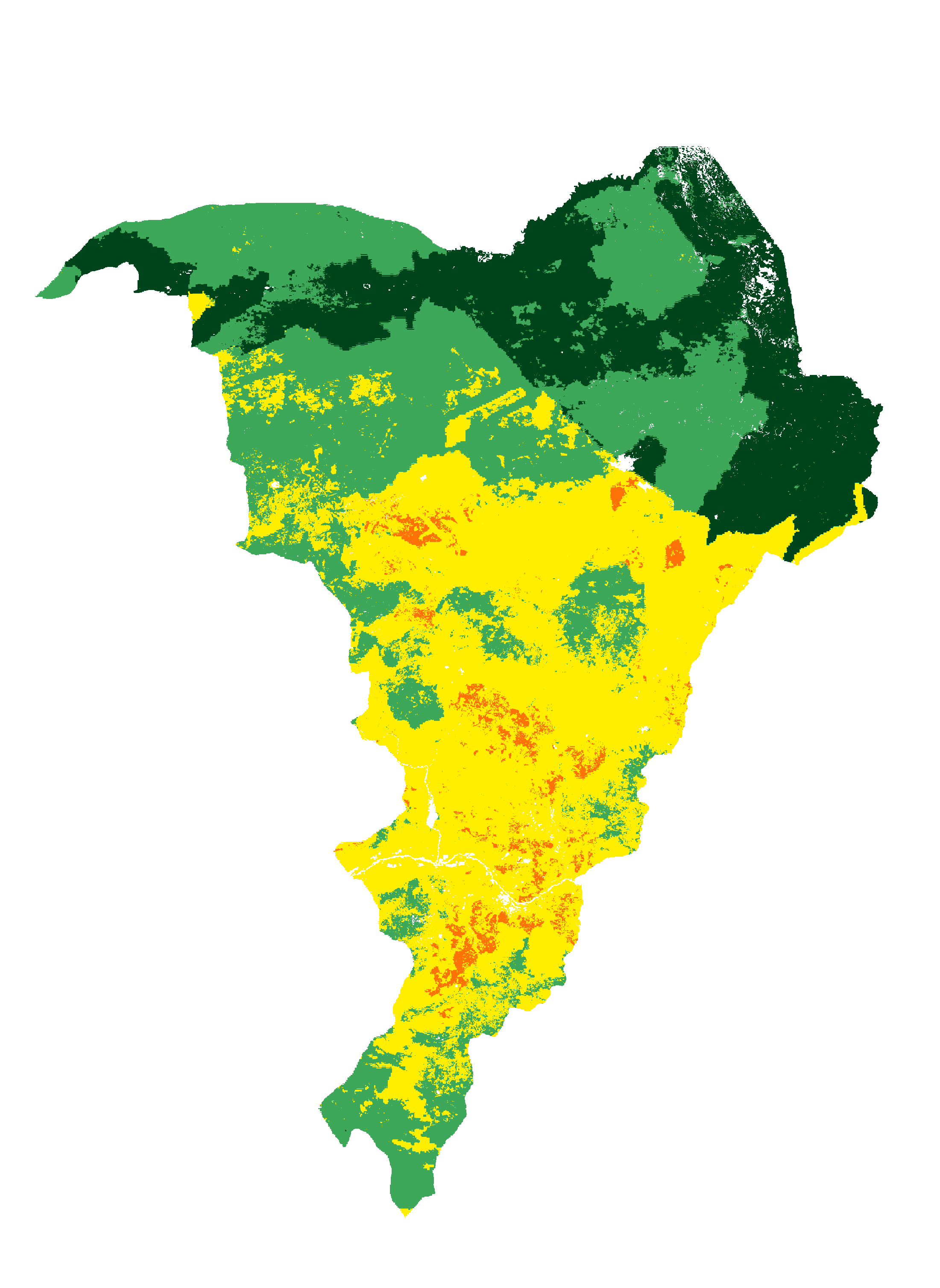
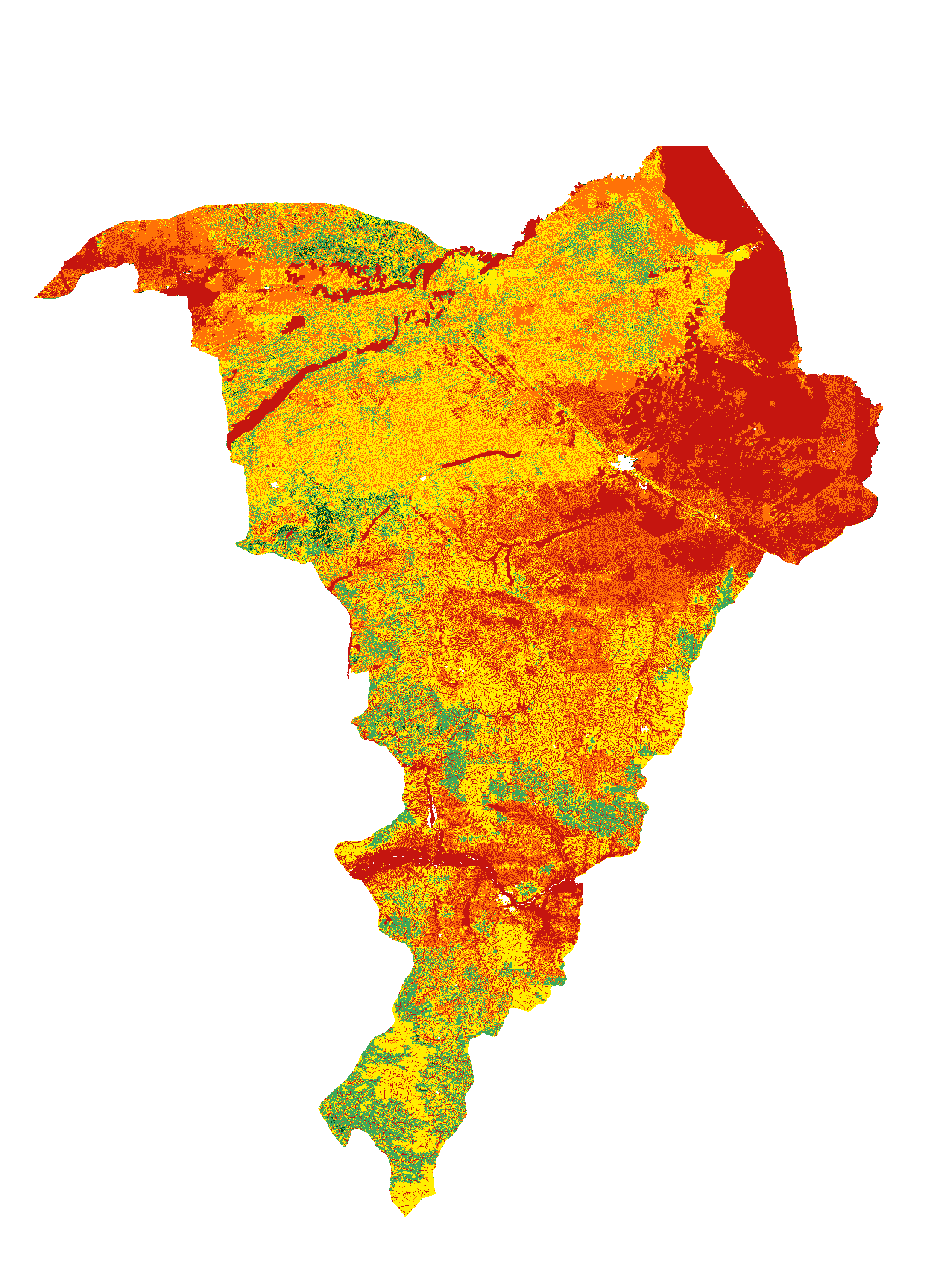
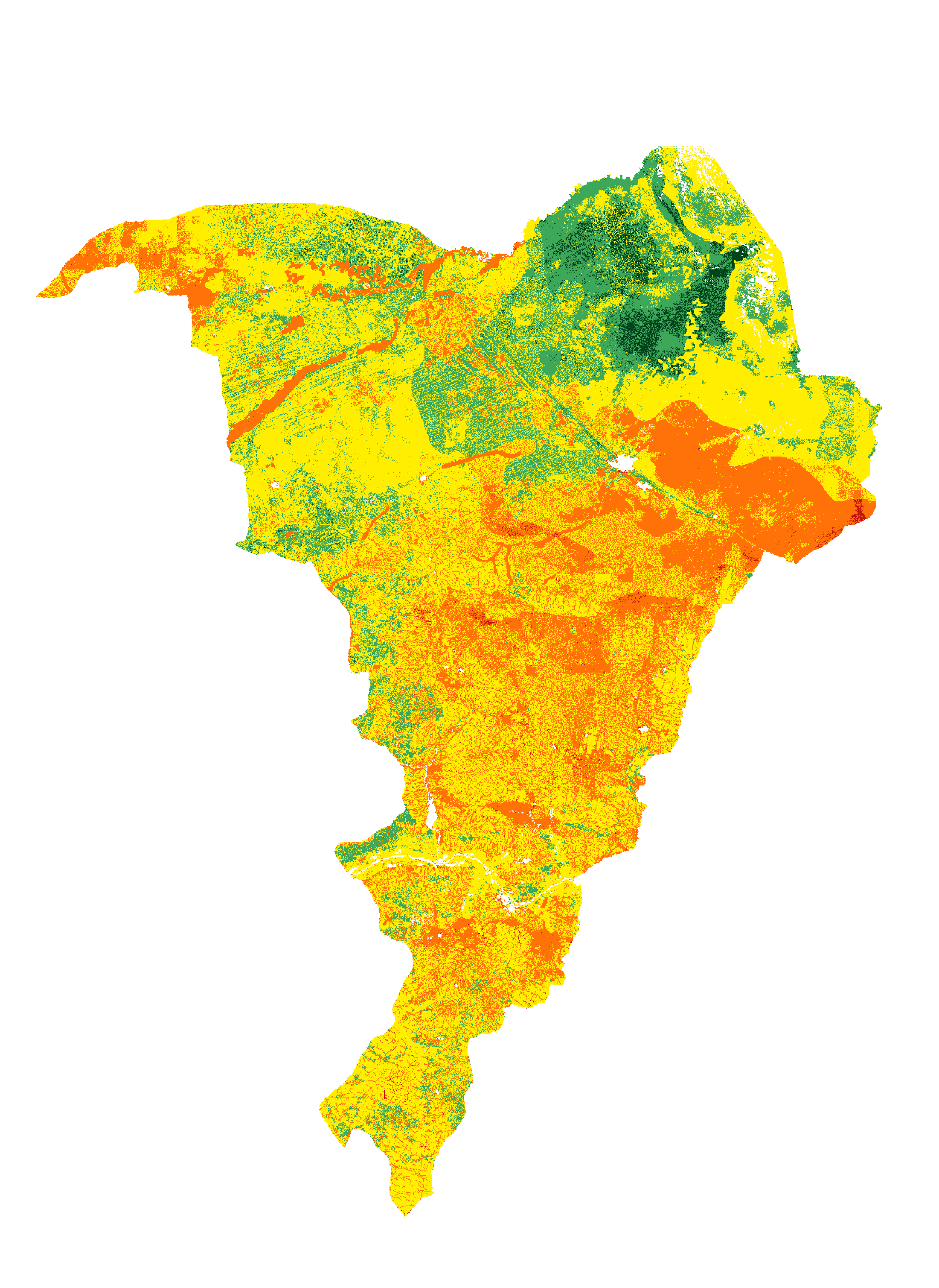
The toolbox consists of five thematic maps:
- Groundwater Availability
- Groundwater Quality
- Environmental Degradation
- Flood Risk
- Terrain Characteristics
These maps collectively form an overall suitability map.
The maps are integrated into a user-friendly web application, enabling IOM and
other stakeholders to easily access the suitability maps from both office environments
and field locations.
This toolbox offers essential baseline information for identifying, prioritizing,
and conducting site-specific studies, such as flood risk assessments with mitigation
plans or water resource evaluations with groundwater development strategies.
The insights generated aim to facilitate decision-making across sectors like WASH and
contribute to the wellbeing, development, and resilience of IDPs.
A detailed explanation of the methodology used to develop these maps can be found
here.
Instructions for using the web application are available in the
User Manual.

International Organization for Migration (IOM) is leading the humanitarian
response in Northeast (NE) Nigeria, where Internal displacement, driven by
conflict and insurgency, has led to the establishment of numerous Internally
Displaced Persons (IDP) camps. More than 504,000 people were estimated to have
been displaced by floods in the BAY states. IDP camps are overcrowded and in
need of support for basic needs like Water, Sanitation and Hygiene (WASH) services.
Climate change and related disasters compound the existing challenges through floods
which are worsened by the flat plains characteristic of the NE Nigeria terrain during the
rainy season, while most rivers run dry during the dry season due to the arid
conditions.
The dynamics of displacement in NE Nigeria are complex, they contribute to
environmental degradation and increases
reliance on unsustainable groundwater extraction. This increases the
vulnerability of IDPs to waterborne diseases and exacerbates their already
challenging living conditions. Therefore, there are government’s plans to decongest
the camps in order to improve IDPs living conditions. IOM collaborates with the
governments and other humanitarian partners in the camps decongestion efforts through
the development of durable solutions.
IOM WASH is contributing to this initiative by ensuring water security of both the
existing and new settlements by leveraging digital solutions to allow decision
makers ensure the suitability settlements locations. To this end, IOM WASH has
partnered with Acacia Water in developing a Digital Suitability Map Toolbox to support
IOM and other humanitarian partners in emergency preparedness and crisis
response.